 TemperateReefBase Geonetwork Catalogue
Biotic taxonomic identification
Type of resources
Topics
Keywords
Contact for the resource
Provided by
Years
-

[This data has been superseded by a synthesised global dataset which includes additional ecological data contributed by non-RLS entities (National Reef Monitoring Network). Please visit the corresponding NRMN Collection (IMOS - National Reef Monitoring Network Sub-Facility - Global off-transect species observations || Global reef fish abundance and biomass) for the most current version of this data. See "Downloads and Links" section below.] This dataset contains records of bony fishes and elasmobranchs collected by Reef Life Survey (RLS) divers along 50m transects on shallow rocky and coral reefs, worldwide. Abundance information is available for all records found within quantitative survey limits (50 x 5 m swathes during a single swim either side of the transect line, each distinguished as a Block), and out-of-survey records are identified as presence-only (Method 0). Although surveys are undertaken as part of monitoring programs at particular locations (mostly in Australia), this dataset contains does not include repeat surveys of sites.
-

An aerial survey was conducted for giant kelp (Macrocystis pyrifera) on the east coast of Tasmania from Eddystone Point to Southeast Cape. This survey represents part of a series of similar surveys, with historic aerial surveys having been conducted in 1986 and 1999. The survey was conducted via light aircraft. Areas of visable Macrocystis pyrifera beds were marked on topographical land tenure maps using landmarks as references, and complimentary photo footage was collected.
-

Observational data for the Kelp Ecosystem Ecology Network. These data come from transects of rocky reefs taken around the world using the KEEN observational data protocol (see http://kelpecosystems.org for full description of methods and handbook). See “How” for methods. Briefly, the observational data consists of the following components, all included here: site information, fish observations, quadrat sampling, band transect sampling, percent cover from uniform point counts, and kelp morphometrics. Data Files Data files included and what they contain are as follows: keen_sites.csv - Physical and locational data for all KEEN sites and transect. keen_cover.csv - Percent cover of sessile algae and invertebrates. keen_fish.csv - Counts of fish by size class along a transect. keen_quads.csv - Counts of common algae, sessile invertebrates, and demersal fish that can be individuated. keen_swath.csv - Counts of rarer algae, sessile invertebrates, and demersal fish that can be individuated. Data Use To use the observational data here for published work we ask that 1) You contact the network coordinator, jarrett.byrnes@umb.edu, and notify them of your intention so that we can coordinate among any ongoing projects using the same data, 2) if the data has not been used in a publication in the literature before, we request that you reach out to the PIs responsible for the data you will be using and engage in a conversation about co-authorship, 3) if it has been used previously, merely cite the datasets associated with each PI that you use. The references are listed below. For access to the entire data cleaning and processing pipeline, see https://github.com/kelpecosystems/observational_data. For access to scans of the original data sheets, contact jarrett.byrnes@umb.edu. ------------------------------------------------------ For general methods: Byrnes, Jarrett E.K., Haupt, Alison J., Reed, Daniel C., Wernberg, Thomas., Pérez-Matus, Alejandro., Shears, Nick T., Konar, Brenda, Gagnon, Pat, and Vergés, Adriana. 2014. Kelp Ecosystem Ecology Network Monitoring Handbook. Kelp Ecosystem Ecology Network. For specific data sets, use the following, but also include date accessed from TemperateReefBase in order to track which version of the data you are using. Byrnes, Jarrett E.K., Haupt, Alison J., Lyman, Ted. 2014. Kelp forest communities at Appledore Island, the Boston Harbor Islands, and Salem Sound. Kelp Ecosystem Ecology Network. Dijkstra, Jennifer A., Mello, Kristen. 2015. Kelp forest communities at York, Maine. Kelp Ecosystem Ecology Network. Grabwoski, Jonathan and MacMahan, Marissa. 2015. Kelp forest communities in Nahant, Massachusetts, and Pemaquid, Maine. Kelp Ecosystem Ecology Network. Humphries Austin T., Paight C, Ben-Horin Tal, Green Lindsay, Thornber, Carol. 2016. Kelp forest communities in Narragansett Bay, Rhode Island. Kelp Ecosystem Ecology Network. Rasher, Douglass and Price, Nicole. 2017. Kelp forest communities of central and downeast Maine. Kelp Ecosystem Ecology Network. Peréz-Matus, Alejandro and Shaughnessy, Brianna. 2017. Kelp forest communities of central and northern Chile. Kelp Ecosystem Ecology Network.
-
The data is the percent algal cover derived from underwater visual census methods involving transect counts at rocky reef sites around Tasmania. This data forms part of a larger dataset that also surveyed fish and megafaunal invertebrate abundance for the area. The aggregated dataset allows examination of changes in Tasmanian shallow reef floral and faunal communities over a decadal scale - initial surveys were conducted in 1992-1995, and again at the same sites in 2006-2007. There are plans for ongoing surveys. An additional component was added in the latter study - a boat ramp study looking at the proximity of boat ramps and their effects of fishing. We analysed underwater visual census data on fishes and macroinvertebrates (abalone and rock lobsters) at 133 shallow rocky reef sites around Tasmania that ranged from 0.6 - 131 km from the nearest boat ramp. These sites were not all the same as those used for the comparison of 1994 and 2006 reef communities. The subset of 133 sites examined in this component consisted of only those sites that were characterized by the two major algal (kelp) types (laminarian or fucoid dominated). Sites with atypical algal assemblages were omitted from the 196 sites surveyed in 2006. This study aimed to examine reef community data for changes at the community level, changes in species richness and introduced species populations, and changes that may have resulted from ocean warming and fishing. The methods are described in detail in Edgar and Barrett (1997). Primarily the data are derived from transects at 5 m depth and/or 10 m depth at each site surveyed. The underwater visual census (UVC) methodology used to survey rocky reef communities was designed to maximise detection of (i) changes in population numbers and size-structure (ii) cascading ecosystem effects associated with disturbances such as fishing, (iii) long term change and variability in reef assemblages.
-
Phytoplankton was counted and identified from five sites over the 5-year period. Annual cycles in abundance are available (as cells mL-1), along with detailed species identification. Cell measurements and approximate geometric shape were also recorded for the calculation of biovolume (μL cell-1). Diatoms and dinoflagellates dominated the samples in terms of biomass, however, small cells were also very abundant throughout each year. The data are restricted to an integrated sample from the top 12 m of the water column. Fluorescence profiles elsewhere in this dataset can provide an indication of phytoplankton presence lower in the water column.
-
The data is quantitative abundance of fish, megafaunal invertebrates and percent algal cover derived from underwater visual census methods involving transect counts at rocky reef sites around Tasmania. This dataset allows examination of changes in Tasmanian shallow reef faunal and floral communities over a decadal scale, with initial surveys conducted in 1992-1995, and again in 2006-2007. There are plans for ongoing surveys. An additional component was added in the latter study - a boat ramp study looking at the proximity of boat ramps and their effects of fishing. We analysed underwater visual census data on fishes and macroinvertebrates (abalone and rock lobsters) at 133 shallow rocky reef sites around Tasmania that ranged from 0.6 - 131 km from the nearest boat ramp. These sites were not all the same as those used for the comparison of 1994 and 2006 reef communities. The subset of 133 sites examined in this component consisted of only those sites that were characterized by the two major algal (kelp) types (laminarian or fucoid dominated). Sites with atypical algal assemblages were omitted from the 196 sites surveyed in 2006. This study aimed to examine reef community data for changes at the community level, changes in species richness and introduced species populations, and changes that may have resulted from ocean warming and fishing. The methods are described in detail in Edgar and Barrett (1997). Primarily the data are derived from transects at 5 m depth and/or 10 m depth at each site surveyed. The underwater visual census (UVC) methodology used to survey rocky reef communities was designed to maximise detection of (i) changes in population numbers and size-structure (ii) cascading ecosystem effects associated with disturbances such as fishing, (iii) long term change and variability in reef assemblages.
-

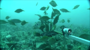
[This data has been superseded by a synthesised global dataset which includes additional ecological data contributed by non-RLS entities (National Reef Monitoring Network). Please visit the corresponding NRMN Collection (IMOS - National Reef Monitoring Network Sub-Facility - Global cryptobenthic fish abundance) for the most current version of this data. See "Downloads and Links" section below.] Reef Life Survey is designed to develop and resource a network of skilled recreational divers for rapid and cost-effective assessment of the state of the inshore marine environment at the global scale. The project uses standardised underwater visual census methods employed by trained SCUBA divers to survey fish and invertebrate species and to record habitat type using photo quadrats - this dataset refers to the cryptic fish and invertebrate survey component only.
-
The Flinders CMR survey was a pilot study undertaken in August 2012 as part of the National Marine Biodiversity Hub's National monitoring, evaluation and reporting theme. The aim of this theme is to develop a bluepint for the sustained monitoring of the South-east Commonwealth Marine Reserve Network. The particular aims of the survey were twofold; 1) to contribute to an inventory of demersal and epibenthic conservation values in the reserve and 2) to test methodologies and deployment strategies in order to inform future survey design efforts. Several gear types were deployed; including multibeam sonar, shallow-water (less than 150m) Baited Remote Underwater Video (BRUVs), deep- water BRUVs, towed video and digital stereo stills. This resource contains the shallow-water BRUV footage captured on the FLinders CMR shelf (less than 150 m). Stereo BRUV's were deployed using a probabalistic and spatially-balanced survey design called Generalized Random Tessellation Stratified (GRTS). Habitats were identified in a previous multibeam survey and consisted of 'mixed reef' (containing patchy reef) and sand. Mixed reef habitat was targeted in this survey (9 GRTS mixed reef sites versus 3 sand sites). A total of 60 stereo BRUVs were deployed. Data contained here represents footage collected using these drops and the associated scored data (abundance (MaxN) and lengths).
-
The main aim of this research program was to determine the potential for reducing the density of urchins to encourage the return of seaweeds and an improvement in urchin roe quality and quantity from remaining urchins. Tasmanian Sea Urchin Developments used two widely-separated sub-tidal experimental lease areas. One of these areas was at Meredith Point, on the east coast, and the other at Hope Island, on the south coast. Both sites had been subject to some overgrazing by urchins. At Meredith Point, the study area was divided into plots containing urchins at three densities: artificially enhanced, continually harvested and control (undisturbed). At Hope Island, controlled clearings of urchins and limpets from barrens areas were conducted. Recovery of vegetation was monitored as well as urchin roe quality and quantity. The data represented by this record was collected at Meredith Point.
-
The abundance of macroinvertebrates associated with 28 experimental artificial reefs supporting different patch sizes and density of kelp (Ecklonia radiata) off Maria Island, Tasmania. Macroinvertebrates were assessed by diver-based visual census conducted between November 2015 and December 2016. This data was collected to examine how the patch size and density of kelp influences the establishment of macroinvertebrate assemblages.